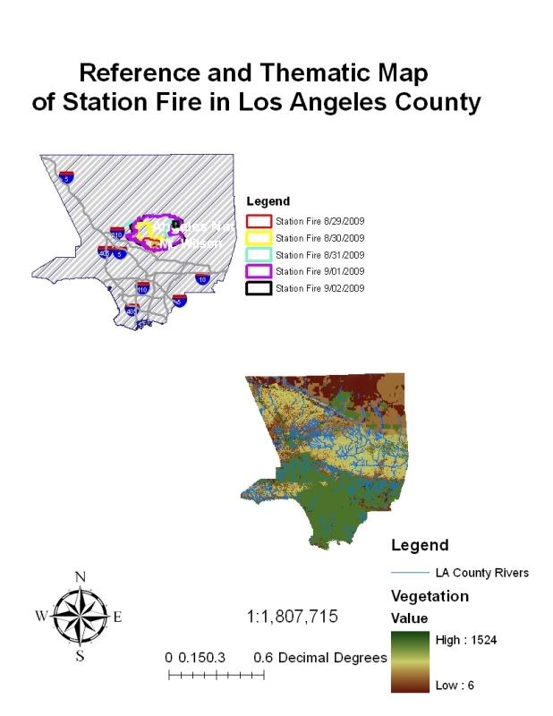
The largest fire in the recorded history of the Angeles National Forest since 1892, began on August 26th, 2009, on the hillside of Mt. Wilson. Referred as the Station Fire, it was also California’s 10th largest fire since 1933. It took over 7,400 gallons of water, burned approximately 160,577 acres, required 34 fire fighters—killing 2— and over a month and a half to completely contain this fire. However, although the Station Fire is 100% contained the forces of Mother Nature are not. Fire and vegetation loss possess tremendous influence on hill slope processes especially in debris flow events.
Commonly described as mudslides, debris flows are common types of fast-moving landslides that typically occur during prolonged rainy events. As precipitation rates exceed the rate of ground infiltration, the excess runoff strips away sediment from hillsides, carries them into the channels and transports them into the lower basins. However, in areas where fires have occurred the chaparral is de-rooted and denuded adding considerably more debris. Because of its increased volume, the debris can no longer be carried away by streams but, now, has enough strength to slide directly down the slope increasing in power.
Debris flows may consist of simply water and silt and clay particles, or of rocky mud carrying trees, boulders and cars. Once the flow hits an even slope, the flow may accumulate into thick deposits extending in a large diameter. This can be both costly and deadly in developed communities. On a national level debris flows are responsible for at least 25 to 50 deaths and 2 billion dollars in clean up annually. Therefore, in the context of the recent Station Fire it is imperative to understand the various factors that trigger debris flow and what their roles are in the event of a landslide.
The factors that influence the occurrence of debris flows are rainfall, slopes, vegetation and wildfire. The center of the fire located at Mt Wilson extends across the San Gabriel Mountains, and makes it very likely for the location of the Station fire to experience debris flow events in the coming winter months (see Fig 1). Southern California possesses a Mediterranean climate that is described by dry summers and wet winters. As little as 7mm of rainfall in a time span of half an hour can trigger debris flow in Southern California. Furthermore, the USGS states that, “any storm that has intensities greater than 10mm per hour (0.4 inches/hour) is at risk of producing debris flow. Temperatures in the San Gabriel Mountains range from an average of 50 degrees Fahrenheit in the winter to an average of 70 degrees Fahrenheit in the summer. The driest month of the year tends to be in July with an average of 0.03 inches of rain and the wettest month of the year is typically February averaging about 4.66 inches of rain.
The major peaks of the San Gabriel Mountains range from 3,207 feet to 10,064 feet. These peaks are accompanied by steep slope angles that speed the momentum of the downward flow of water. The amount of debris transported depends on the speed of the water flow; the faster the flow the more debris it can pick up. Runoff and erosion accelerate because of wildfire events. Infiltration capacity of soils decreases as a result of fire. Prolonged heavy rains increase soil moisture. The saturated soil may fail, causing an infiltration triggered landslide. This occurrence is common up to two years after a wildfire event. The extreme heat of the wildfire creates a soil condition in which no water can be absorbed and instead accumulates a waxy-like layer just below the ground surface.

No comments:
Post a Comment