
Map projections endeavor to portray the Earth on a flat surface. Inevitable distortions accompany these attempts involving deviations in distance, direction, scale, and area. The Projections in ArcGIS Lab focused on three types of map projections: equal area, equidistant, and conformal. By creating maps through the use of ArcMap, I realized the significance, perils, and potential of each type of projection.
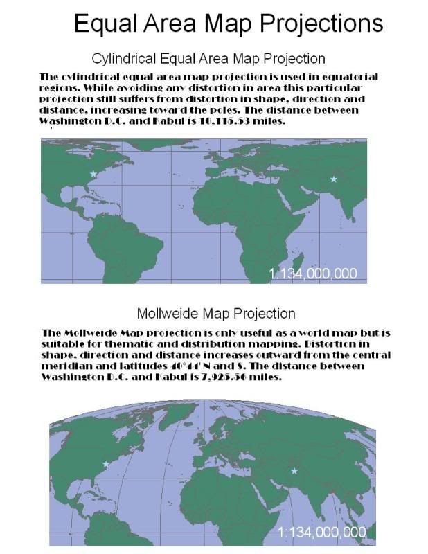
The first type of projection I included in this blog is the equal area projection. Map projections of equal area possess the same proportional relationship to the represented areas on the Earth. Within this category I chose to illustrate the world through cylindrical equal area and Mollweide map projections (Figure 1). Cylindrical equal area maps exemplify the method of a normal perspective onto a cylinder with points intersecting at the equator. The Mollweide projection encapsulates a pseudo cylindrical equal area projection method, in that all the parallels and the central meridian are straight lines and meridians (with the exception of the central meridian) are elliptical arcs. The shape of the cylindrical equal area map projection stays true along the standard parallels and increases in distortion towards the poles. In the Mollweide projection the shape stays true at the intersection of the central meridian and latitudes 40˚ 44’ North and South with distortion also increasing outwards from the intersection towards the poles. The direction and distance behave in the same way for both cylindrical equal area and Mollweide map projection where the accuracy diminishes as measurements are taken farther from the standard parallels for the cylindrical equal area and at the aforementioned intersection for Mollweide. Equatorial regions possess the greatest benefit in the application of cylindrical equal area map projections since it is a narrow area extending along the central line. This particular projection suffers a limitation of severe distortion near the poles. The Mollweide map projection plays a useful role in thematic or distributive mapping of the world, but is only useful as a world map. Goode’s Homolosine and Boggs used a combination of Mollweide and Sinusoidal map projections.
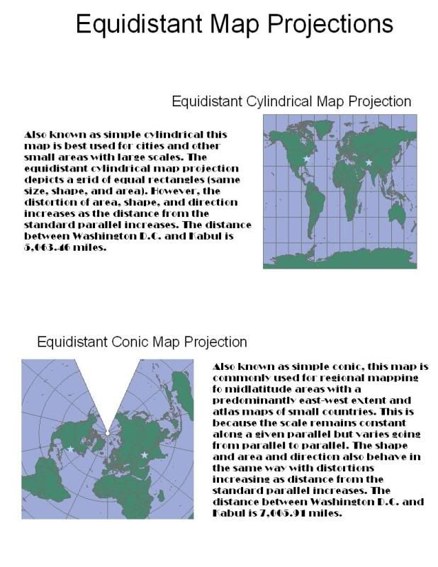
The second type of projection, included in today’s blog is the equidistant map projection. Defining a map as an equidistant projection involves a portrayal of distances from the center of the projection to any other place on the map. Constant scale is preserved along all great circles from one or two points. Figure 2 shows a map with an equidistant cylinder projection and a map with an equidistant conic projection. The construction of an equidistant cylinder projection entails a conversion of the globe into a Cartesian grid where every rectangle possesses the same size, shape and area. The equidistant conic projection has the option of being based on one or two standard parallels. Graticules are evenly spaced with the representation of poles as arcs instead of points. In both projections shape and area distortion increases as distance from the standard parallel increases. Furthermore, accuracy in direction locally along the standard parallels is observed in cylindrical and conic map projections. The equidistant map projection achieves its maximum potential when used in city maps or used as a simple portrayal of regions with minimal geographic data. Index maps emphasize the usefulness of this specific projection. When using conic map projections range in latitude should be limited to 30˚, thus making it useful in regional mapping of mid-latitude areas extending predominantly east and west. Atlas maps of small countries commonly use conic map projections, although it was used by the former Soviet Union in mapping the entire country.
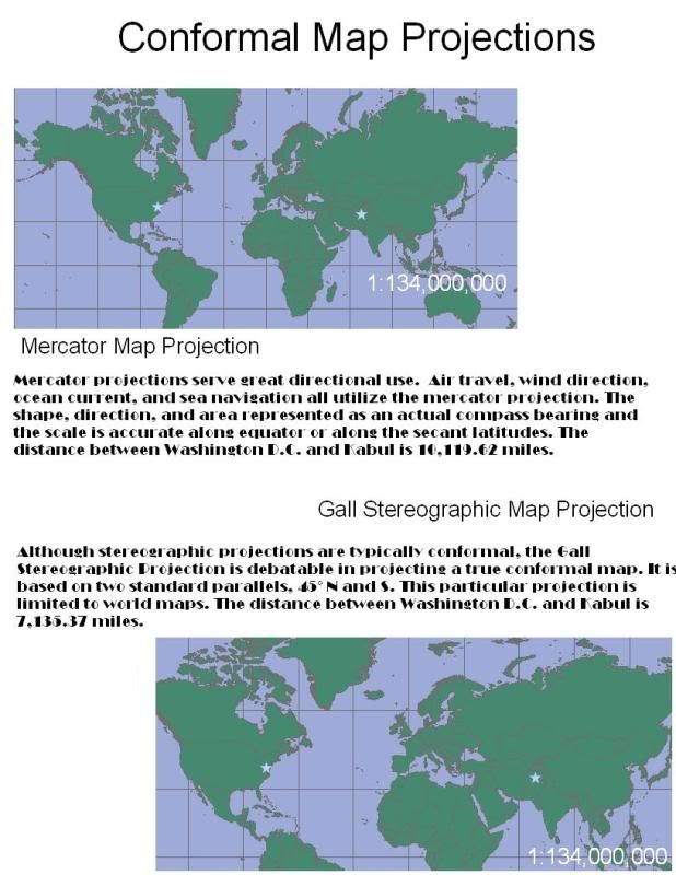
The final map projection type, as shown in Figure 3, is the conformal map projection. Used primarily for navigational purposes conformal maps contain parallels and meridians that intersect at right angles. Across the map lies a constant scale while preserving local shapes and angles. The original intent of the Mercator projection was to display accurate compass bearings for sea travel. Since this projection maintains local angular relationships, small shapes are well represented. The area and direction result from the fact that any straight line drawn on this projection represents an actual compass bearing. As mentioned, navigational and directional functions, like air travel, wind direction, and ocean currents depend on the Mercator projection. However its best use applies to equatorial regions or, regions near the equator, like parts of the Pacific Ocean or Indonesia.
Although it is included under the conformal map projection category, the Gall Stereographic map projection is, in fact, not exactly a conformal map projection. It is included because stereographic maps are typically conformal in that they conserve the shape of circles in addition to conserving perspective. The reason that the Gall Stereographic map projection is not a conformal map is because it projects the world on a cylinder with two standard parallels at latitudes 45˚ North and South. The shape, among other properties, such as direction, distance and area, is only conserved at these latitudes with distortion increasing towards the poles. British atlases employ the Gall Stereographic however its application strictly limits itself to world maps.

No comments:
Post a Comment